This week begins my article series on redistricting possibilities across Florida. Each week I will look at an area of Florida and hypothesize how the maps may turn out.
Series Explainer
The goal of this series is to take a look at different areas in Florida and see how the legislative lines may end up. These articles will focus on how lawmakers may draw districts to accommodate changing populations. I will talk about different areas, what mandates (namely minority representation) they have, and what might need to happen due to population changes. I will also, at times, examine what efforts to gerrymander a region will look like. After the 2012 gerrymandering was discovered by a Florida Court, I believe it is appropriate to treat legislative intent with some healthy skepticism. “Fair maps” can – at times – be in the eye of the beholder, but the goal will be to identify what would likely be partisan decisions by lawmakers.
I highly recommending reading my History of Florida Redistricting series – as many mandates and norms we have in our maps are a product of that history. Prerequisite reading is absolutely my 2022 Primer Article – which covers which districts are under-populated and what the racial benchmarks are.
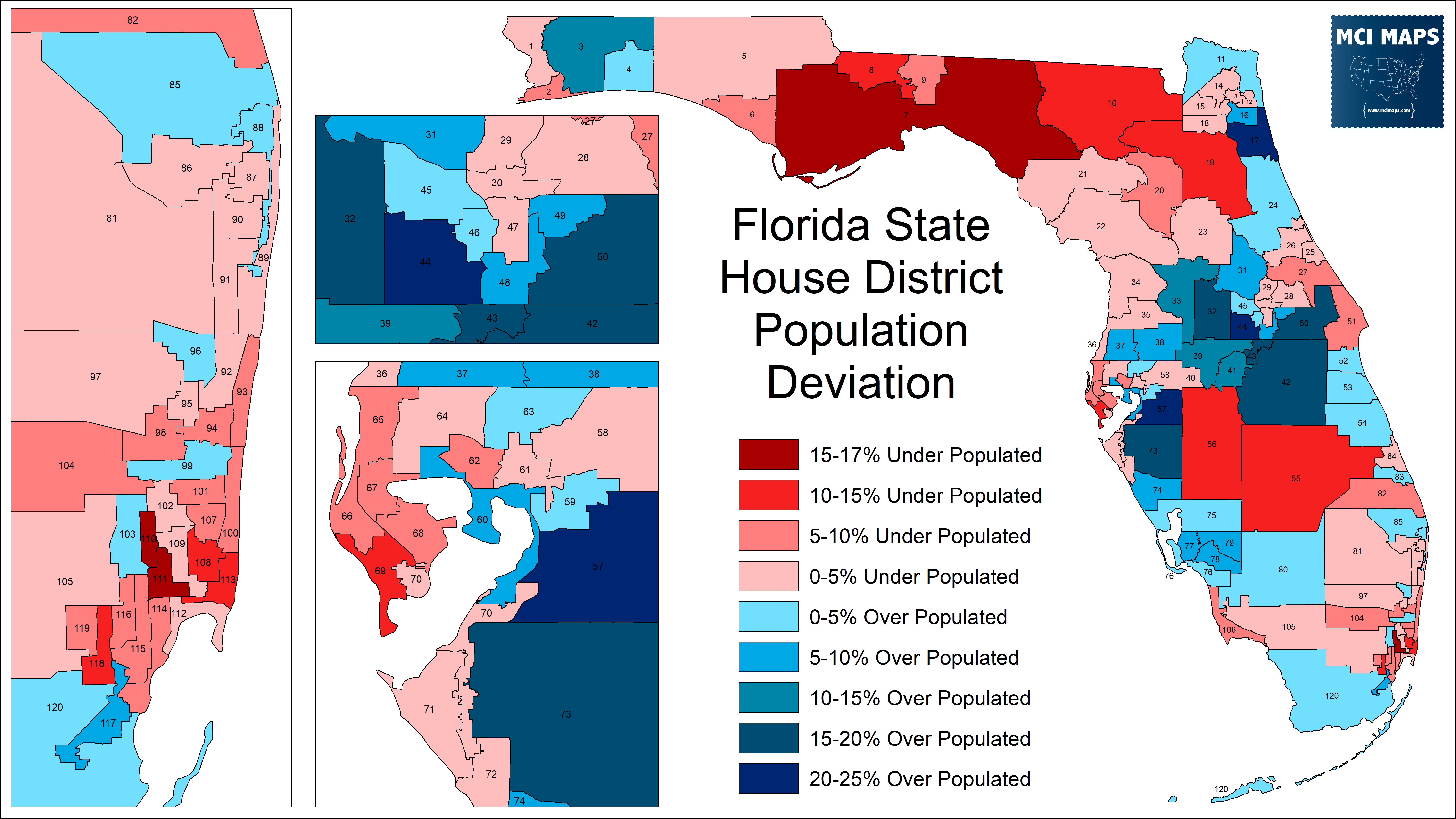
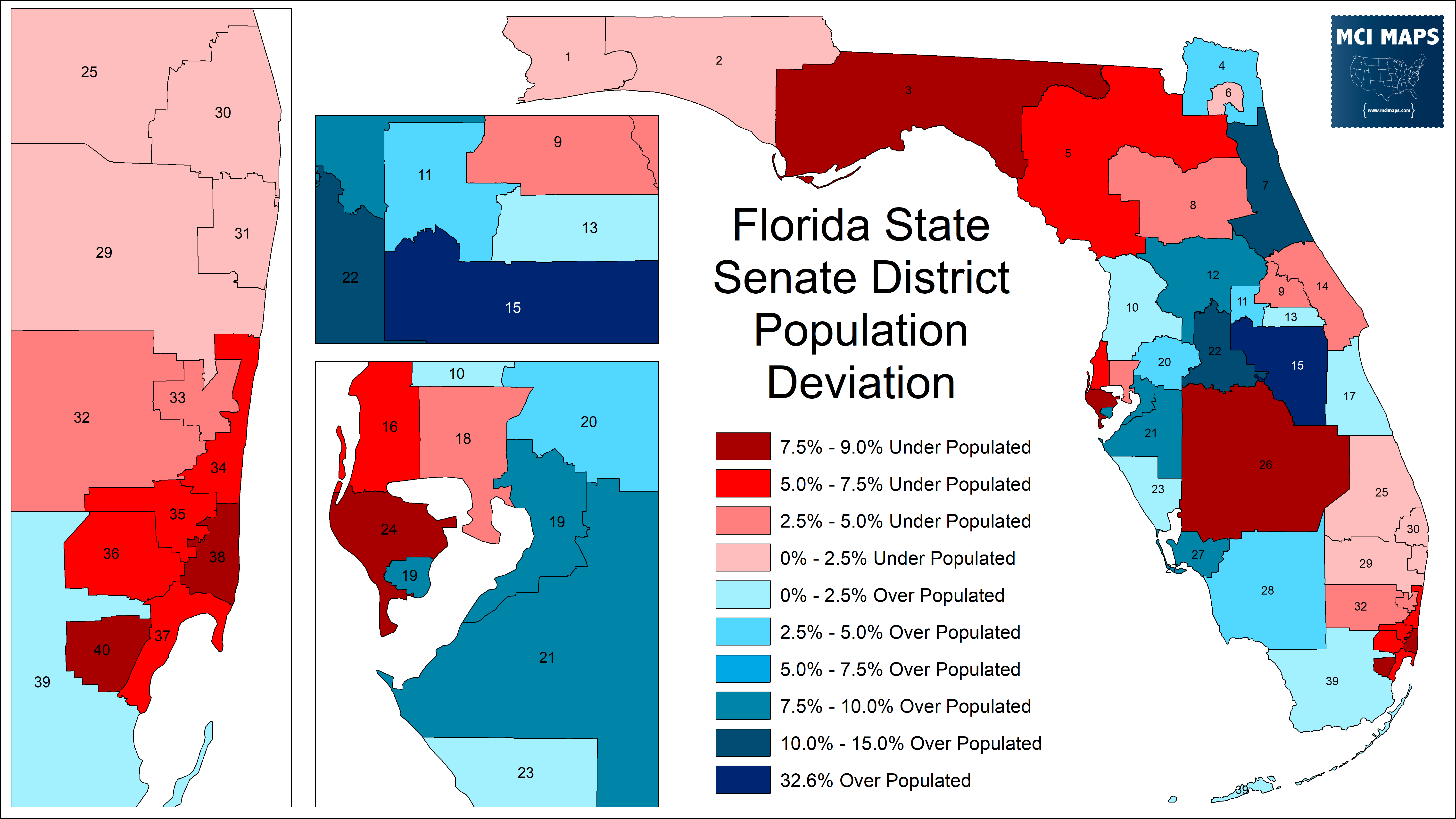
The full spreadsheet of district stats – including population and racial makeup – can be found here.
An important glossary to remember:
- BVAP = Black Voting-Age population
- HVAP = Hispanic Voting-Age Population
- Functional Analysis = using political turnout data to confirm minority performance in a district. Utilizing both general election and primary election performance for parties and racial groups.
Lets begin this series by looking at North Florida!
Panhandle State House
The first area I’m going to look at is the Tallahassee region. Florida’s panhandle is going to be tricky to draw in the state house plan. HD7, the rural district around Tallahassee, is 16% underpopulated. HD8, a historic African-American district that covers Gadsden and Leon, is 13% underpopulated. HD9, which represents FSU and suburban Tallahassee, is only 7% underpopulated. In 2012, lawmakers were able to keep HD8 and HD9 confined to the Gadsden/Leon area. This will be impossible in 2022. The 8th or the 9th must leave the region to grab more voters. The trick is the rural neighboring counties are low in population; with huge swaths of land needed to grab a decent number of voters.
There are two realistic options. The first is that HD8 grabs Calhoun and Liberty counties. The two rural, white, deep-red counties would make up just 25,000 of the district’s 180,000 residents. The district would be 47% BVAP and would continue as an African-American district (solidly blue and overwhelmingly black in a primary). This layout would also allow the 9th to remain within Leon and keep it from splitting its eastern neighbors.
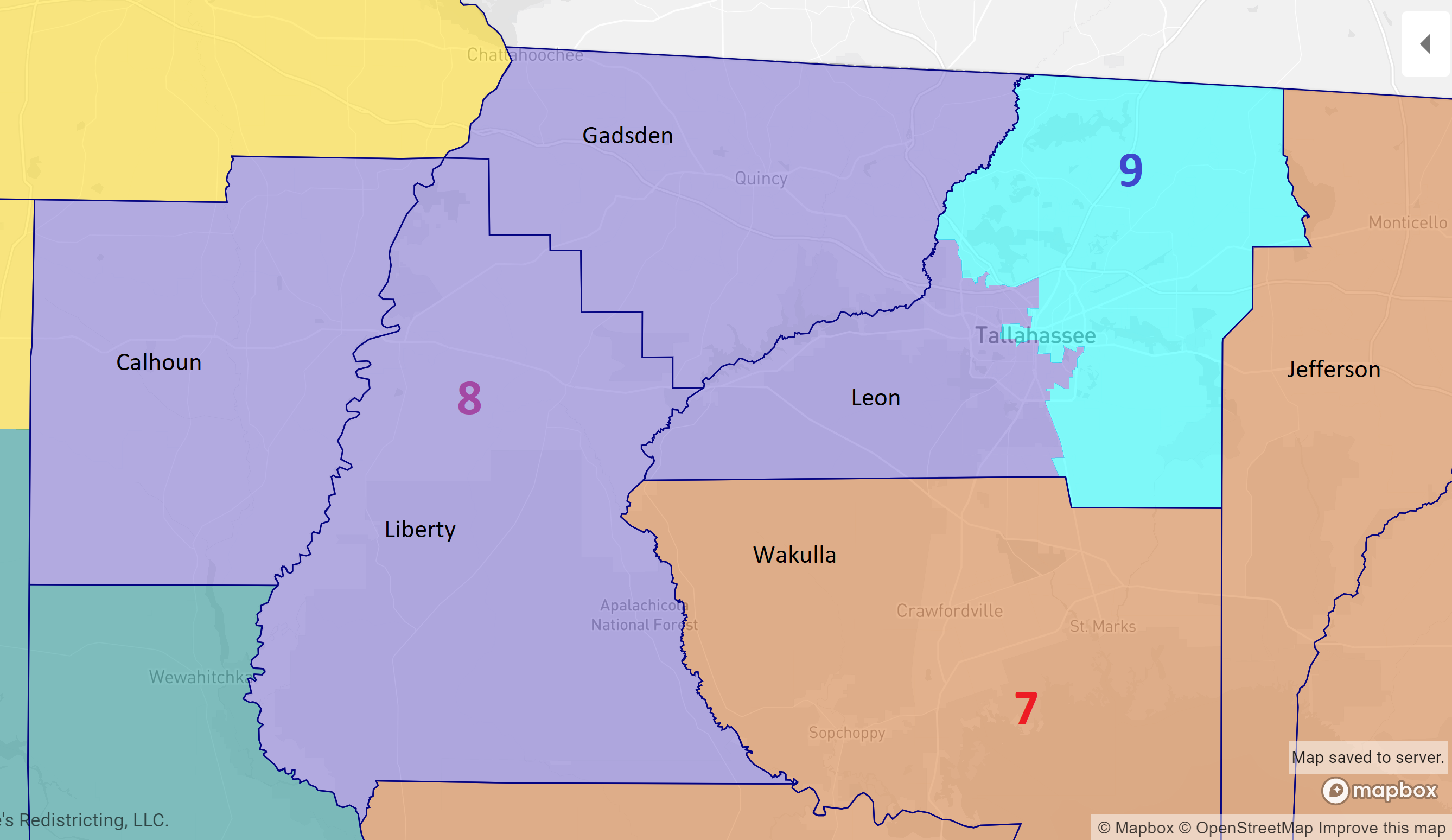
Now, this is not an ideal paring – and is reminiscent of the 1980s state house plan for the region. However, it might be the only option.
The alternative proposal is to keep HD8 largely the same, giving it some of the Tallahassee precincts. This would also lead to around a 47% BVAP for the 8th. The 9th would then need to move east. It can’t take Wakulla to its south, or southern Jefferson (that area is needed to connect the 7th from Calhoun and to the east). The 9th would need to split Jefferson and go into Madison to get to an acceptable population.
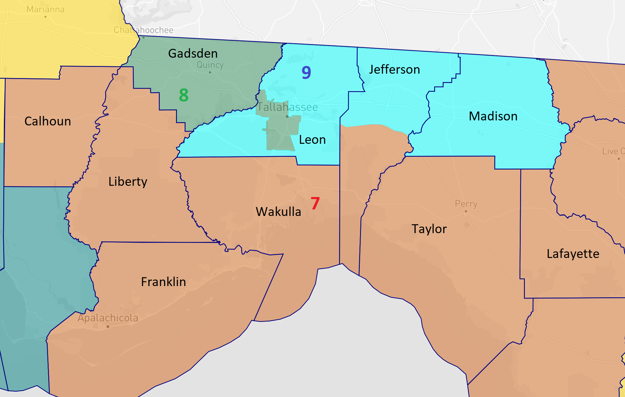
The one known fact is that some of the Leon/Gadsden rural neighbors are going to be sucked into a new seat. Whichever rural counties get picked will be outgunned by the Gadsden/Leon core.
Panhandle State Senate
The overwhelmingly likely story with the panhandle’s state senate districts is that everything will move east. The 1st and 2nd districts are close to the ideal population – while the 3rd is 9% low. The biggest likely change is the 3rd as to move further east.
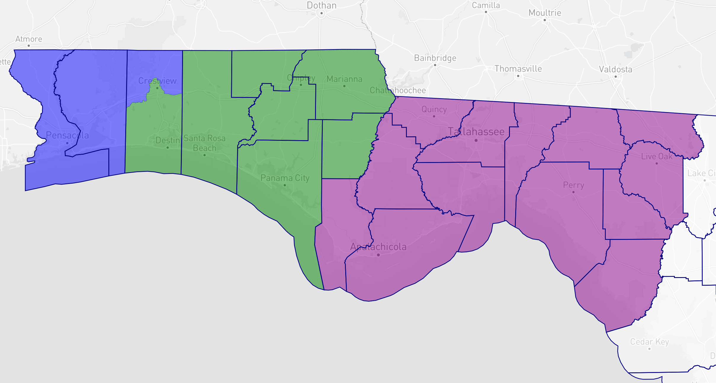
The 3rd is likely to lose Calhoun and take in Suwannee, Lafayette, and Dixie. It will continue to be dominated by Tallahassee and Gadsden, but with additional rural influence. Politically-speaking, the GOP will love this – as its going to result in an SD3 that is much more modestly Democratic. The current 3rd backed Biden by 9%. This version only did by 3%.
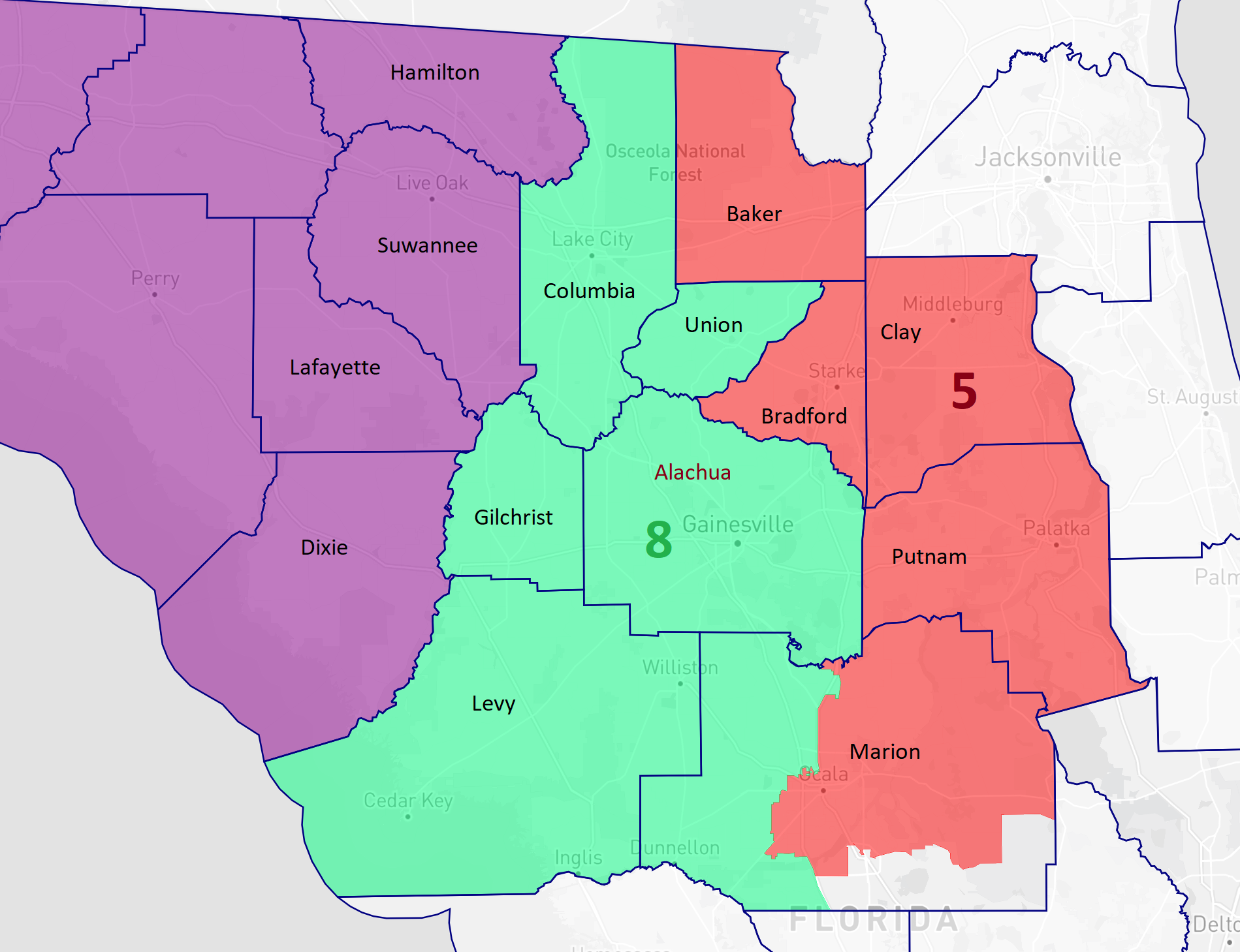
Gainesville State House
The Gainesville area is likely to be a notable source of contention – though it only effects two districts. For decades, Gainesville has been split between two seats. HD20 is an African-American access seat. The district has been around 30% BVAP, but is safely Democratic and elected African-American candidates in the Democratic primary. Therefor it is a functionally black seat and this must continue into 2022. The 20th grabs African-American voters in Alachua (Gainesville) and then moves south to grab African-Americans in Marion (Ocala).
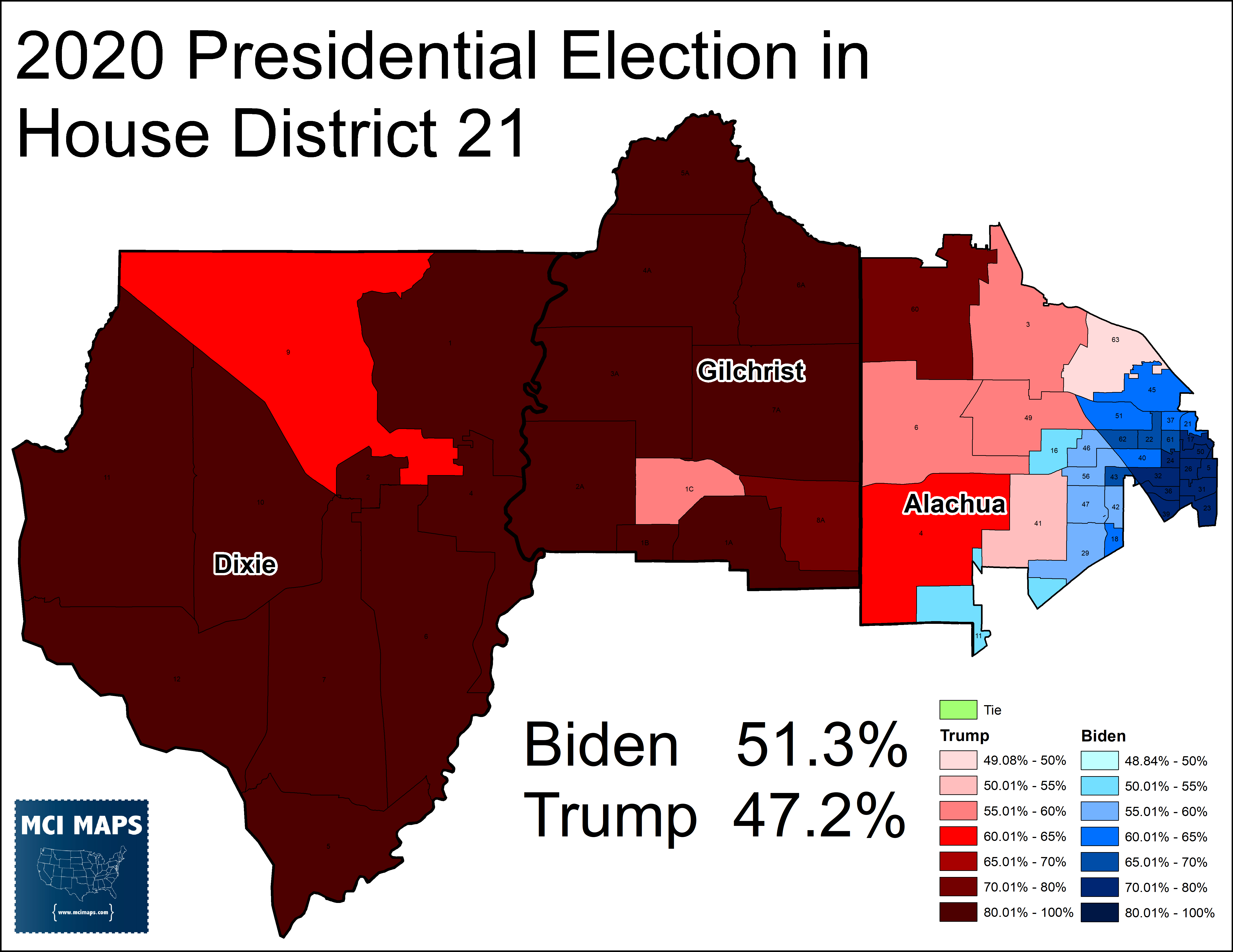
The biggest point of contention will be HD21 – which is currently in the ultimate of shotgun marriages. HD21 is currently made up of the Gainesville suburbs, the University of Florida – and then DEEP red Dixie and Gilchrist counties.
What effects HD21 the most is where the 20’s borders stop. The most likely map will have 21 take in the rest of Alachua (which largely includes the UF campus, the Gainesville suburbs, and western rural communities) – and grab Gilchrist as well. HD20 is underpopulated and needs new voters no matter what. This below map works to take in communities while also balancing the black population numbers.

This is where I could see Republican manipulation the most. The more of Alachua that’s in the 21st, the more Democratic leaning it is. HD21 in the above plan is 55% Biden. Republicans would much rather give more of Alachua to 20 and force 21 to grab more rural, Republican voters. This plan below would work.
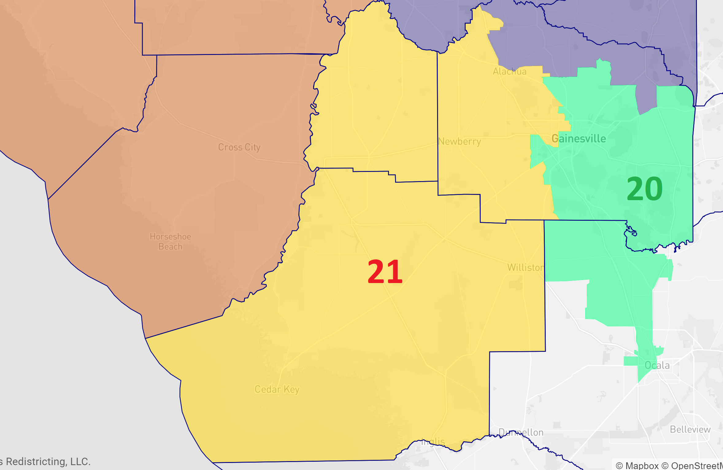
This plan’s version of the 20th is 26% BVAP (down from the other plan’s 28%) – which is due to the fact any additional precincts grabbed from Alachua are all heavily white. This plan would also put the northern portion of Alachua in the rural HD10 (what the current map does). This creates a HD21 that is 52% Trump.
Key point to watch here – how is the UF campus treated? Most of the student population is heavily white. Will map drawers split the community – keep it all in 20, or allow it all in 21?
Gainesville State Senate
Since SD3 will have moved further east, its less likely the current 5th will continue its path of going west around Gainesville.
One possible set of districts for the area can be to have the 5th link some of the rural counties to the west and south of Clay. The 5th could move into Marion county on the south end. The 8th, meanwhile, can keep Alachua and Marion/Ocala – while also grabbing the needed populations from rural Gilchrist and rural Levy.
Regardless of the map, a state senate district anchored around Alachua/Gainesville has been the norm. The question becomes which neighbors it is paired with. That pairing heavily influences the partisan nature of the district.
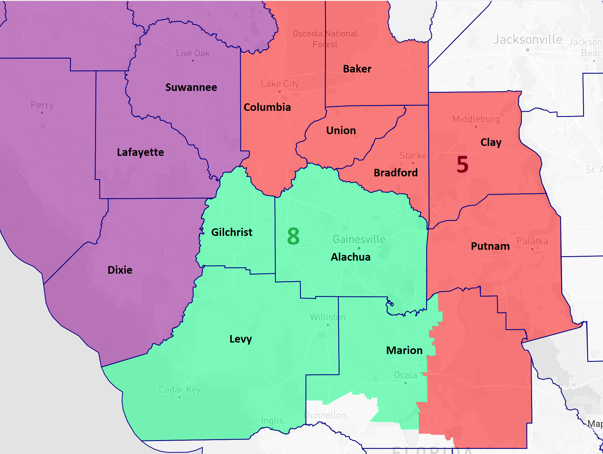
What Republicans could do to ensure the 8th remains in their column is to separate Ocala from Gainesville. This proposal would give Ocala to the 5th and have the 8th take in Columbia and Union.
This map would turn the Biden +1.4 into a Trump +3 district.
This isn’t the only way they could draw the lines to preserve GOP rule in the region. However, I think it is the most likely (in some form). I posed a question on twitter – why wouldn’t the GOP support the map below?
The map seen above keeps district 3, 5, and 8 all made up of whole counties – no splits. It also creates a solidly-GOP 8th; at Trump +6. In fact, that 8th is a similar version of the state senate district they used from 2012-2016.
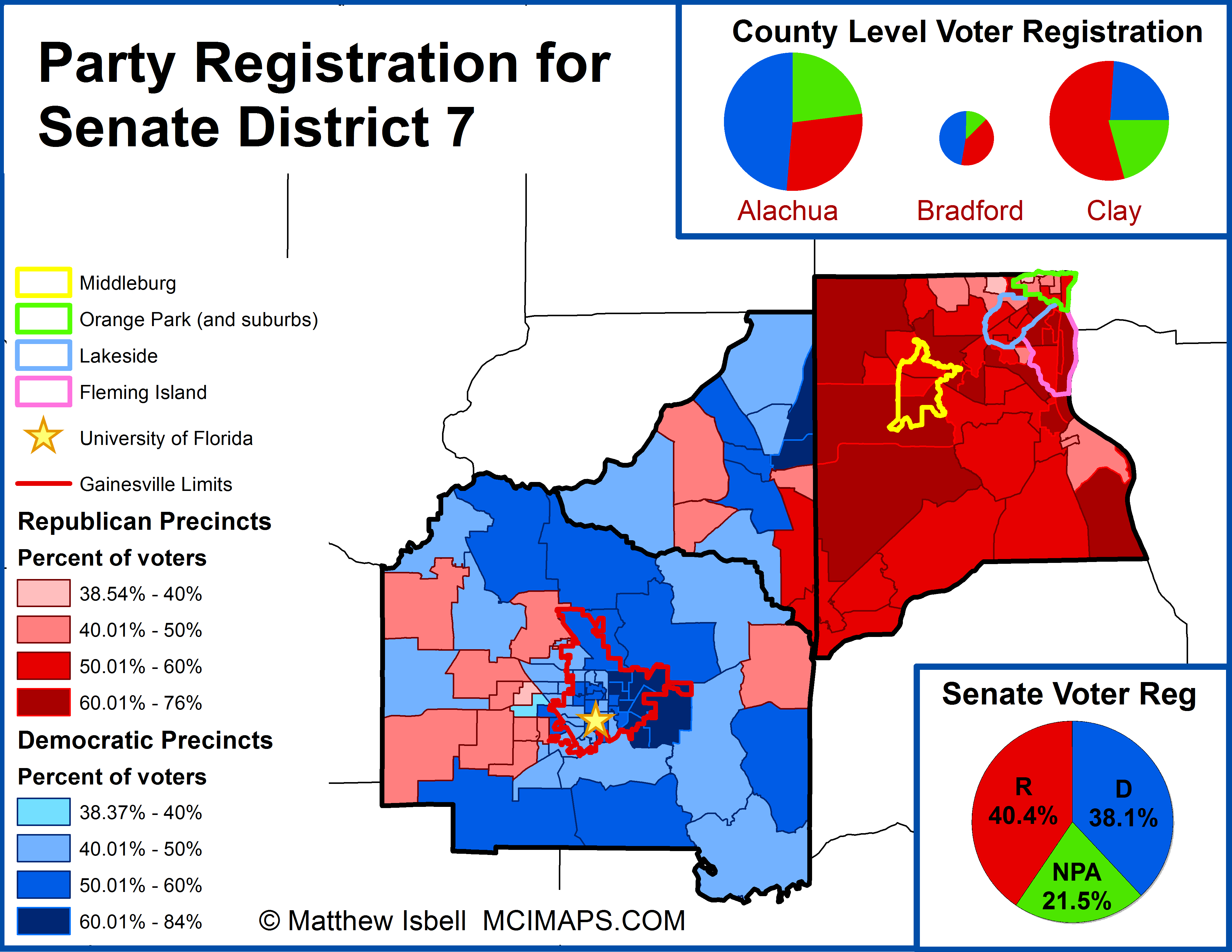
The pairing of Alachua and blood-red Clay ensured a steadily Republican seat. I referred to this type of district in a 2015 article as compact gerrymandering. So why won’t the GOP do it this time? Because GOP Senators live in Clay and Alachua.
Rest assured – if the GOP engages in direct gerrymandering – don’t be shocked if it also works out perfectly with Senator’s not being linked together.
Jacksonville State Senate
The State Senate map in Jacksonville is almost a lock to remain similar to the current lines. An African-American district, housed within Duval County, has been the norm since 2012 and is unlikely to change. The current 6th district is 40%+ African-American. It is functionally an African-American seat; safely Democratic in generals and with a majority-black Democratic primary.
Updated lines can easily replicate this district – with a BVAP of 45%.

Honestly the biggest difference to the area is that the 4th cannot cover all of Duval before the population maxes out – proof of Jacksonville’s growth.
Jacksonville State House
In 2012, Nassau and Duval County were able to perfectly house six state house districts. Thanks to their respective population growths, six districts can still be housed within – but with a few thousand extra voters.
A map that largely replicates the current districts is broadly possible.
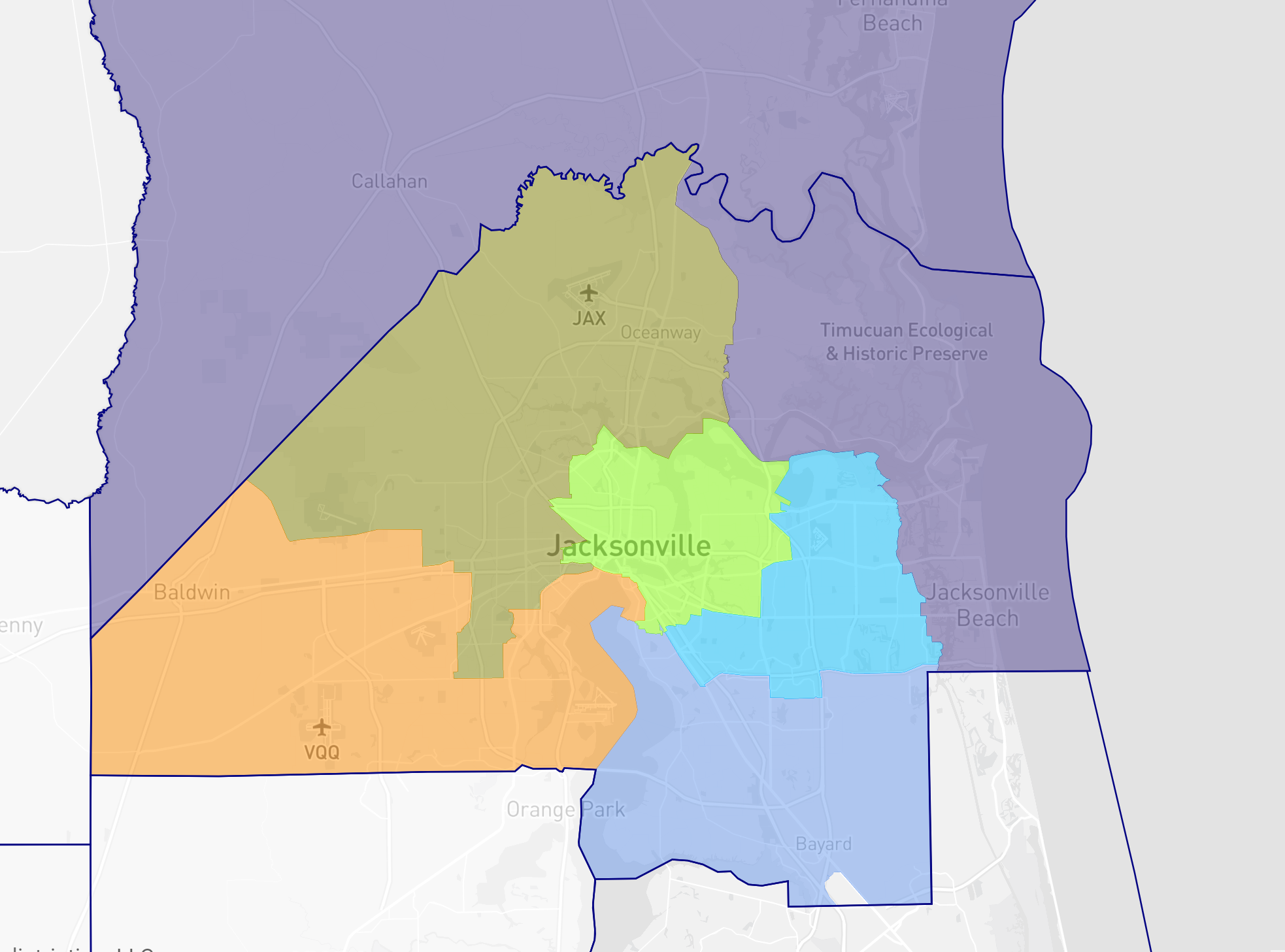
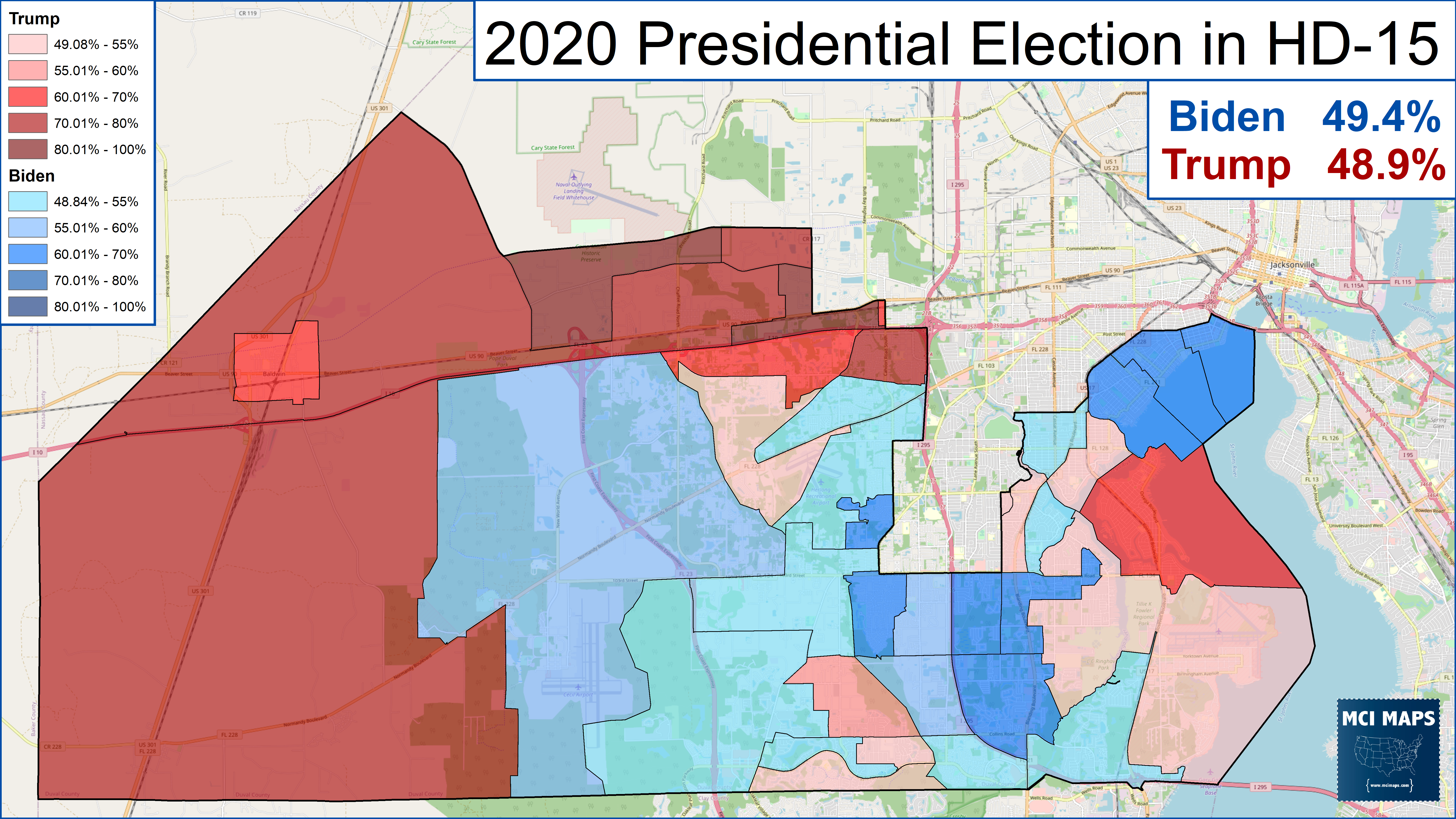
The biggest X-factor in the Duval region is Southwest Duval. The current 15th district has seen a notable shift over the last decade. Originally drawn as a fairly stand Republican, suburban district; this seat has seen a great deal of political shift. The district has gotten much more diverse; going from 65% white voting-age to 53%. As the area has grown more diverse, it has also become more Democratic. The district went from being Trump +8 in 2016 to Biden +1 last year.
So what is the debate with the 15th? Well its a question of racial representation vs partisan desires. The fact is, the 15th could be redrawn to increase minority influence in the Jacksonville delegation.
Below is a possible new plan – which turns the 15th into an African-American access district.
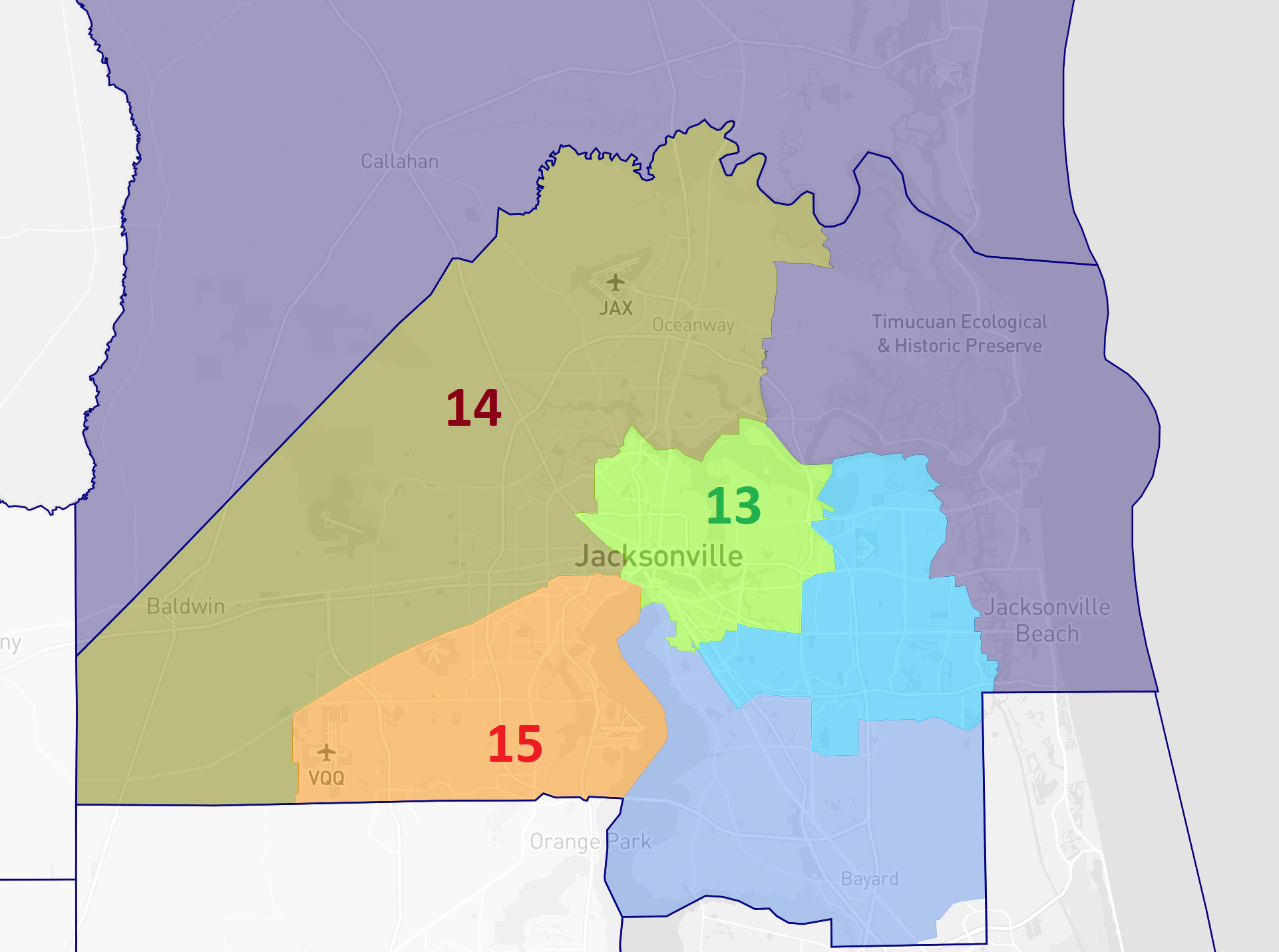
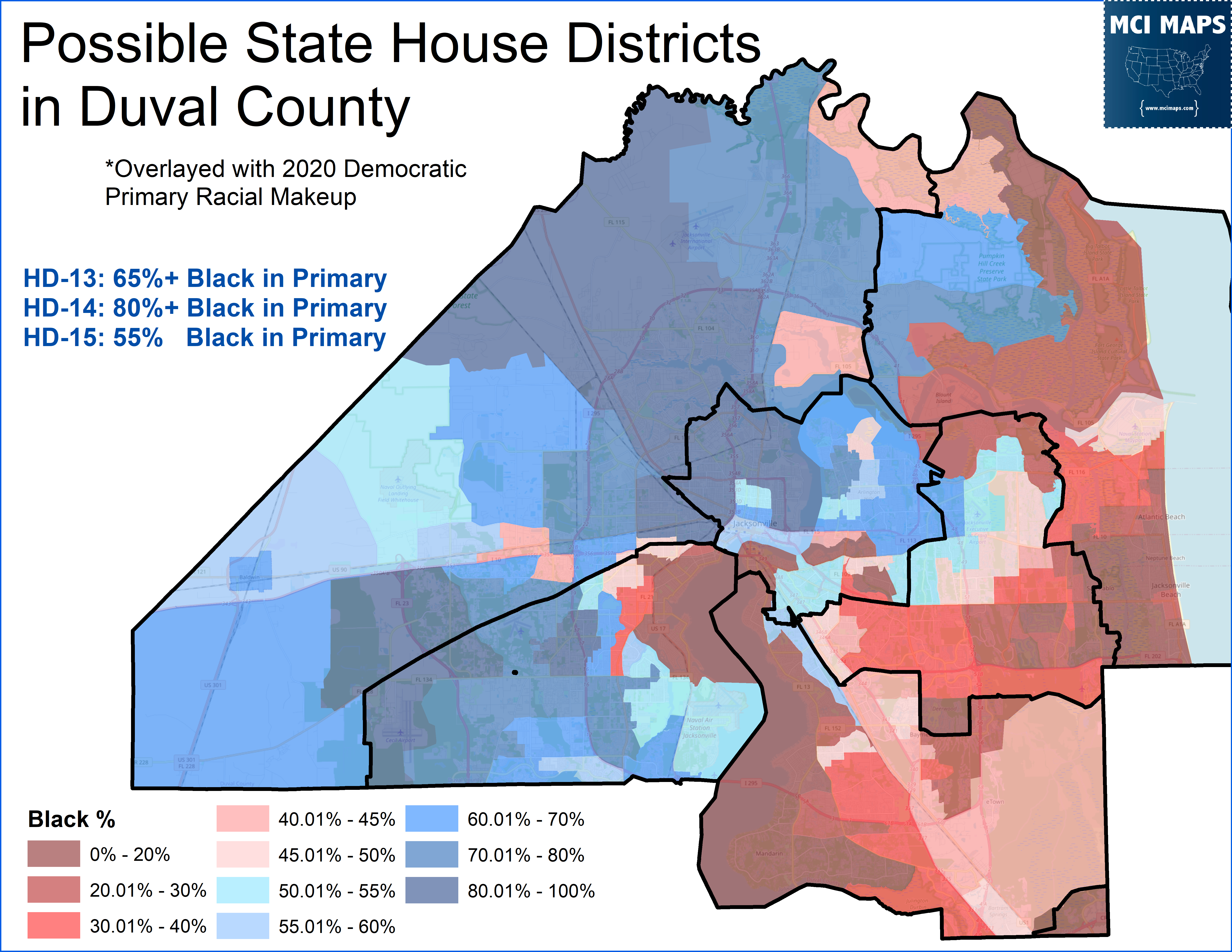
In the above plan, the 15th would be 50% voting-age population white and 33% BVAP. This would be, in practice, a likely African-American district. The district would reflect the growing diversity of the southwest region of Jacksonville. This can be done while keeping the 13th and 14th as solidly African-American districts. In this map both seats are between 48% and 51% BVAP.
This version of the 15th would likely lead to a third African-American district in Duval county. Such a seat would be 55% African-American in a Democratic primary: in a Biden +11 district.
So Duval would then have two historic African-American districts, and a diversifying functionally-black third district. This would reflect the growth diversity within the county.
Of course, such a plan would not be favored by the Republican majority. It honestly would not surprise me if the map aims to sabotage a Democratic HD15. There are ways this can be achieved. The plan below is one way. Having the 14th take diverse/democratic precincts, giving liberal Riverside to the 13th, and forcing the 15th across the St Johns River.
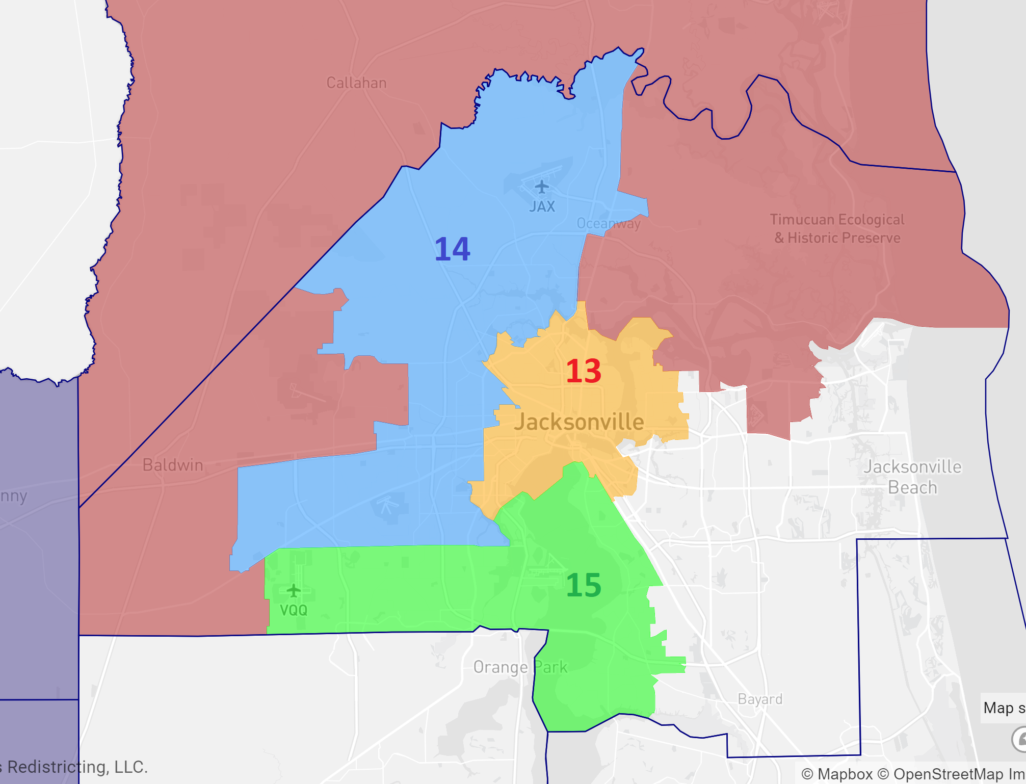
This proposal would lead to a much less diverse 15th; with it’s white voting age population at 59%. This 15th would easily be Republican, backing Trump by 8%.
So….. we will see.
Conclusion
That covers some of the high-profile regions of North Florida to watch out for. Next week I will be looking at the State House map in the Orlando area.